
While the image of the United States at night is stunning:

Egypt's night image tells a more interesting story:

There should be no question that civilizations thrive around water - just look how the city lights follow every twist and turn of the Nile River. Both ancient and modern civilizations have built their cities around this important river, dependent on it for everything from agriculture and industry to drinking water. I love how this one image seems to tell all of Egypt's history.
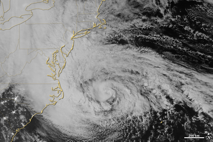
Before I get too poetic, though, let me add that although these images are amazing, they aren't the end goal of any NASA or NOAA project - just a wonderful by-product. Most weather satellites are equipped to analyze data during the day. The satellites launched for this NASA/NOAA project are equipped with a new sensor, called the Visible Infrared Imaging Radiometer Suite, that is sensitive enough to capture the light from a single ship in the ocean. If that fact doesn't absolutely amaze you just go home - you're not welcome here anymore. The new sensors were also used to capture this image of hurricane Sandy (Notice the lights visible through the clouds in North and South Carolina).
These satellites will be used to better understand the dynamic movements of clouds as well as energy and water balance, vegetation dynamics, and polar ice.
Need more science? Check out our or follow us on
.